

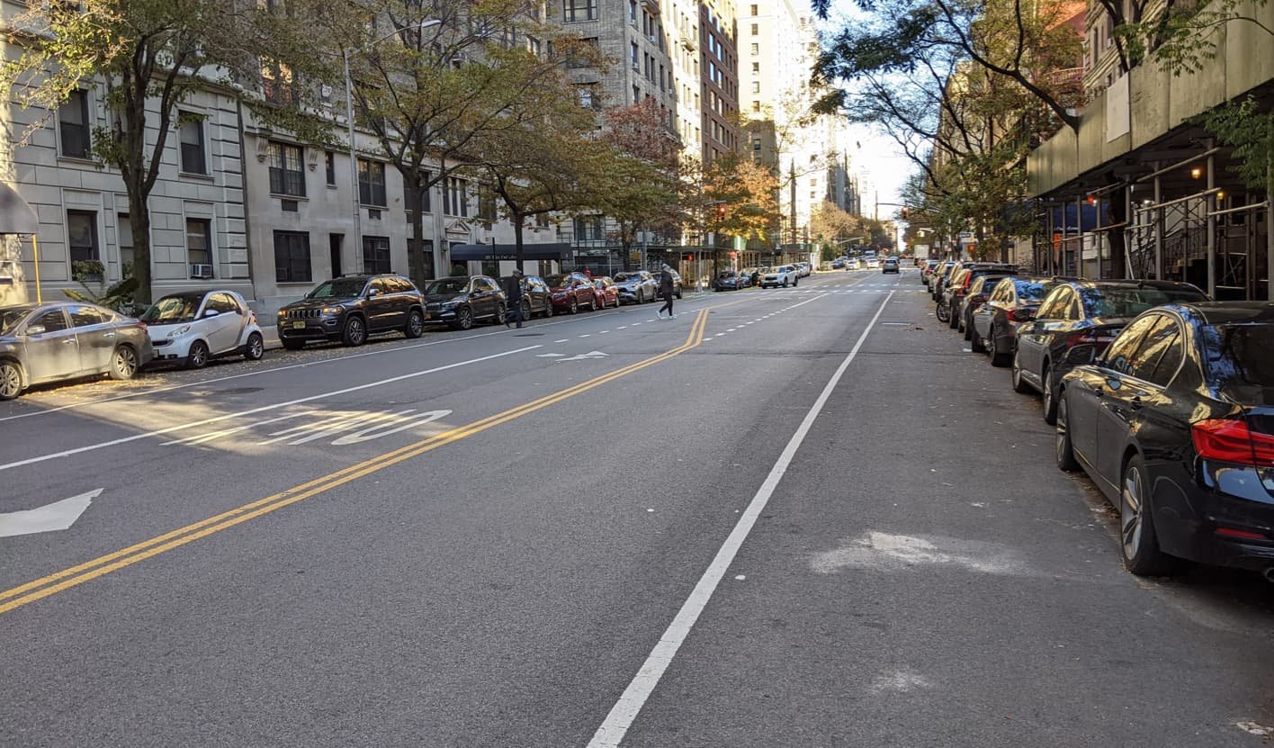
If you squint at the Upper West Side on the New York City Bike Map, you can start to see the bones of what could be a comprehensive micromobility network. We were interested in what those lines on a map feel like on the ground.
How is the infrastructure experienced by riders? How accessible is it to people with different levels of comfort and confidence using micromobility, particularly more vulnerable riders? Does it get people where they need to go?
Over thirty volunteers of varying riding confidence collectively spent over seventy hours documenting every block of every designated bike lane on the Upper West Side to try to get some insight to those questions. [See our field survey methodology.]
With this information in hand, we identified six key elements to better understand how the infrastructure is experienced and whether it supports everyone who is currently choosing, or would like to choose, to use micromobility to get around. [See our lane rating methodology here.]

Width: Are the lane widths adequate for all users, devices, and uses? Is social riding possible? Is it comfortable to pass?
Separation: Is there sufficient separation or protection from moving vehicles?
Intersections: Are riders protected from turning vehicles at intersections? Are intersections comfortable and easy to navigate?
Surface: Is the surface smooth and well-maintained?
Legibility: Is the route intuitive and recognizable?
Continuity: Are the safety features of the lane continuous? Is the lane free of obstructions?


Picture a person in your life who would be vulnerable riding a bicycle or scooter in an urban environment—a child or a grandparent, perhaps, or someone just a bit extra cautious about their safety. Does the current infrastructure get this vulnerable rider safely and comfortably where they need to go under all conditions? That’s the lens through which we viewed each lane.
Some key takeaways:
None of the current bike lanes on the Upper West Side are fully supportive of more vulnerable riders.
Unprotected lanes are precarious and uncomfortable for most riders.
Unprotected intersections and other gaps in protection—where riders are forced to mix with automobiles—are dangerous to all riders.
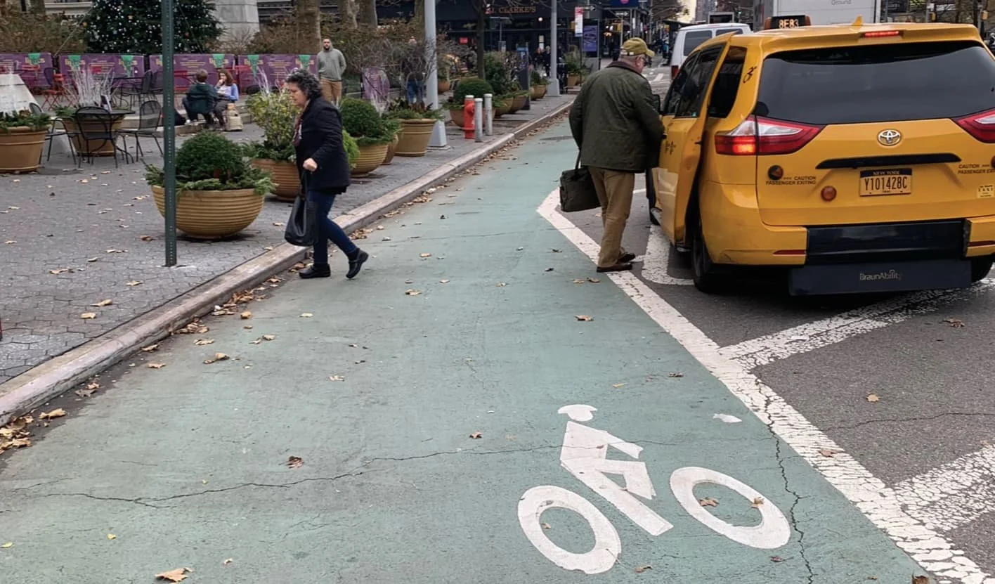
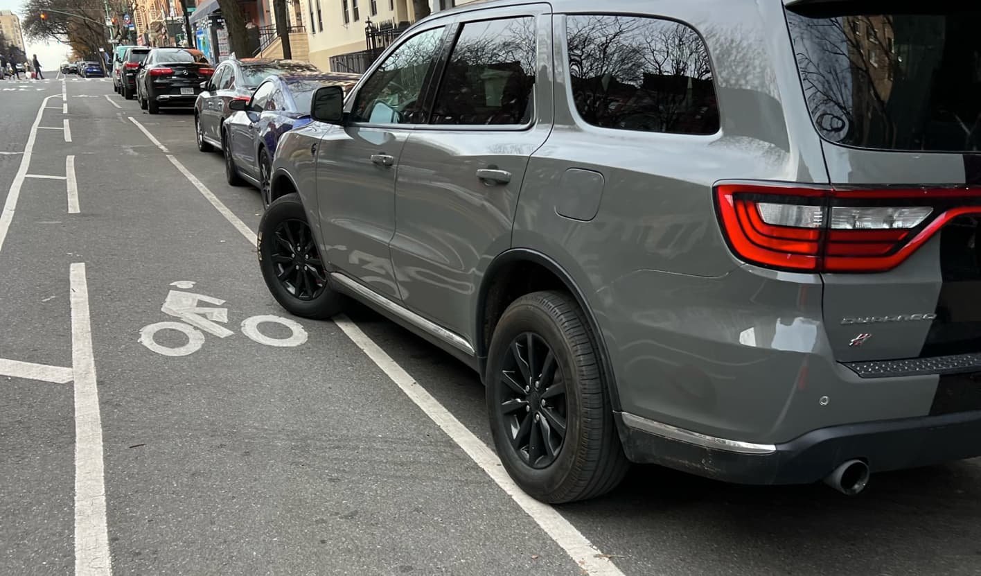
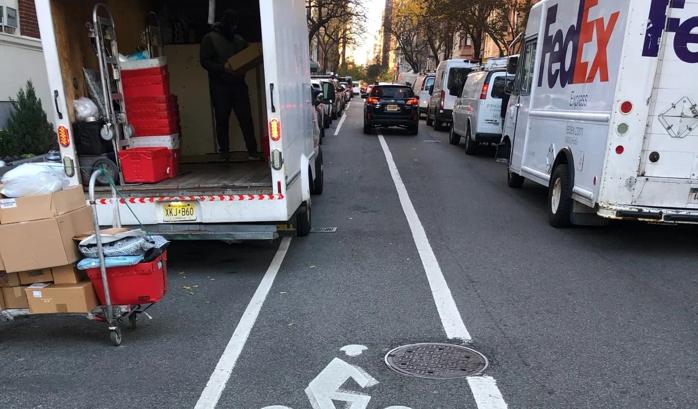
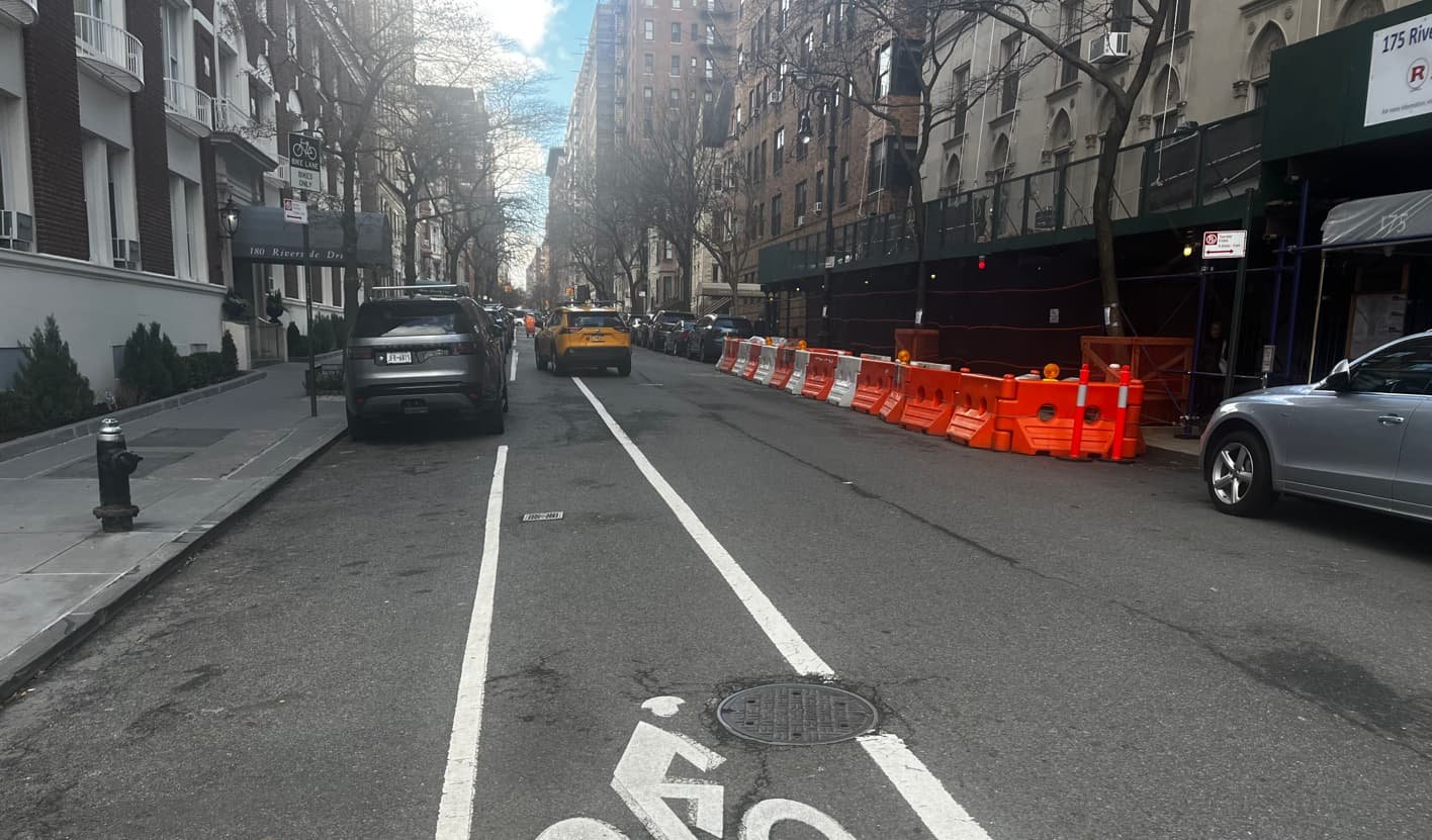
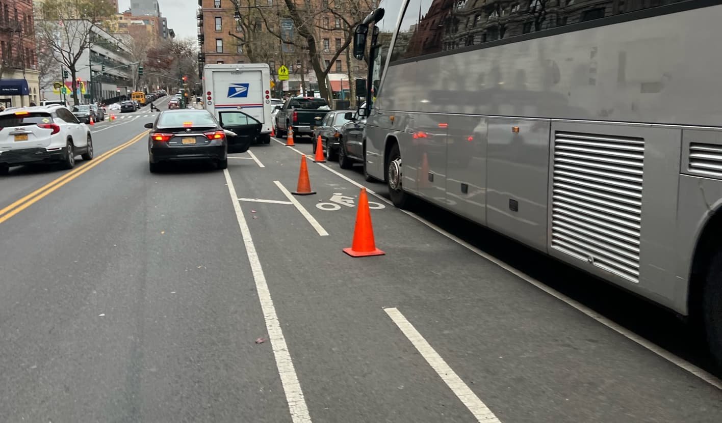
Notably, we found portions of all bike lanes to be regularly obstructed by vehicles—a major concern for micromobility riders. On average 11% of blocks on lanes designated as protected were observed to be obstructed by vehicles, compared to 56% of blocks on unprotected lanes. [3.1]
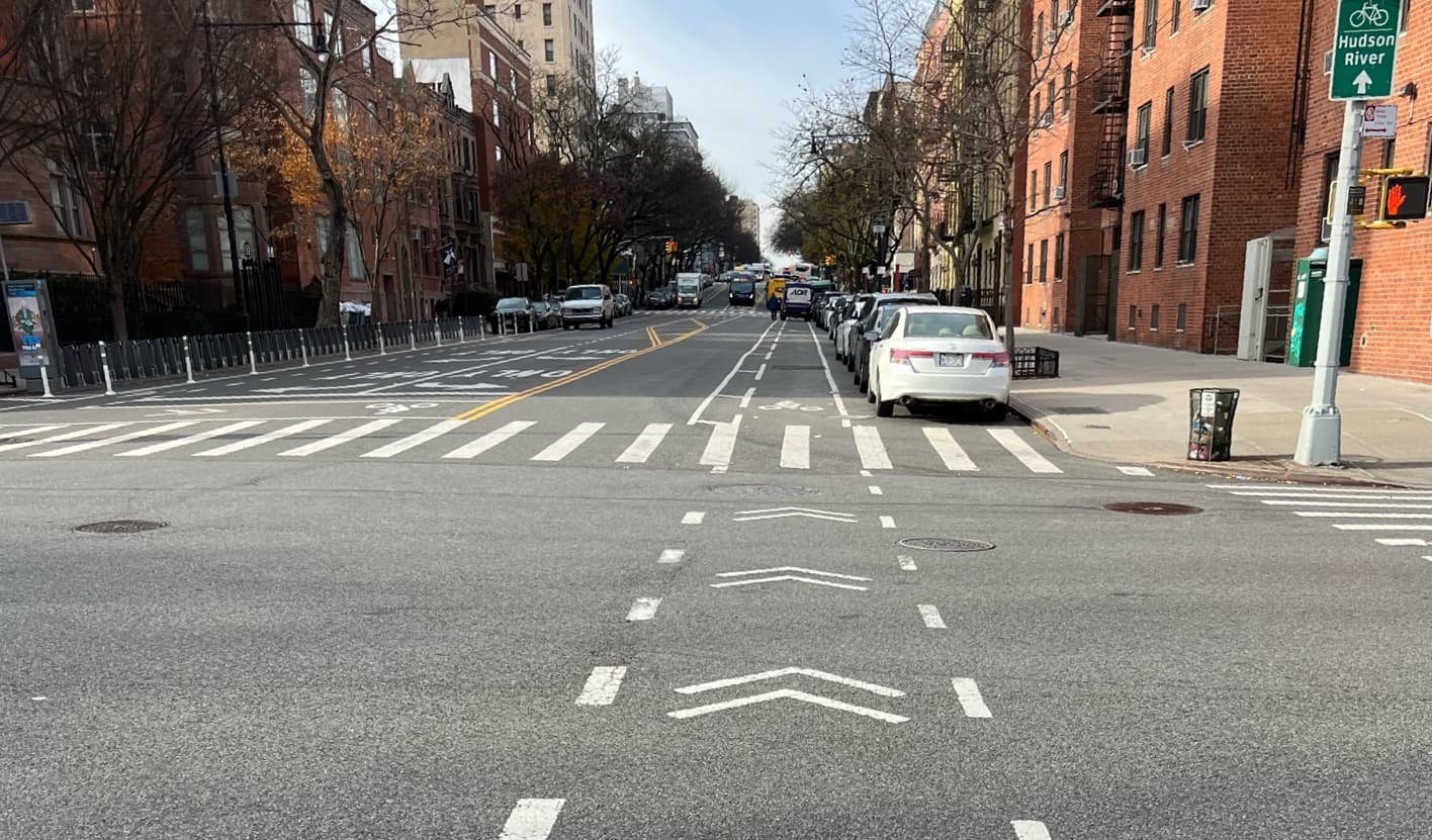
Explore below to see details of what we observed and how well the existing infrastructure supports the people using it, especially the most vulnerable riders.
The Lanes

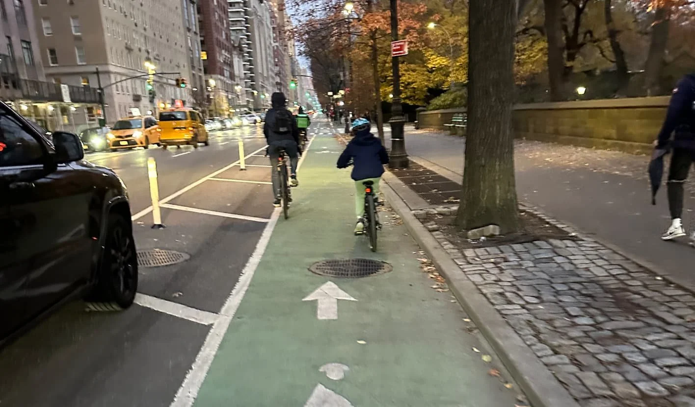
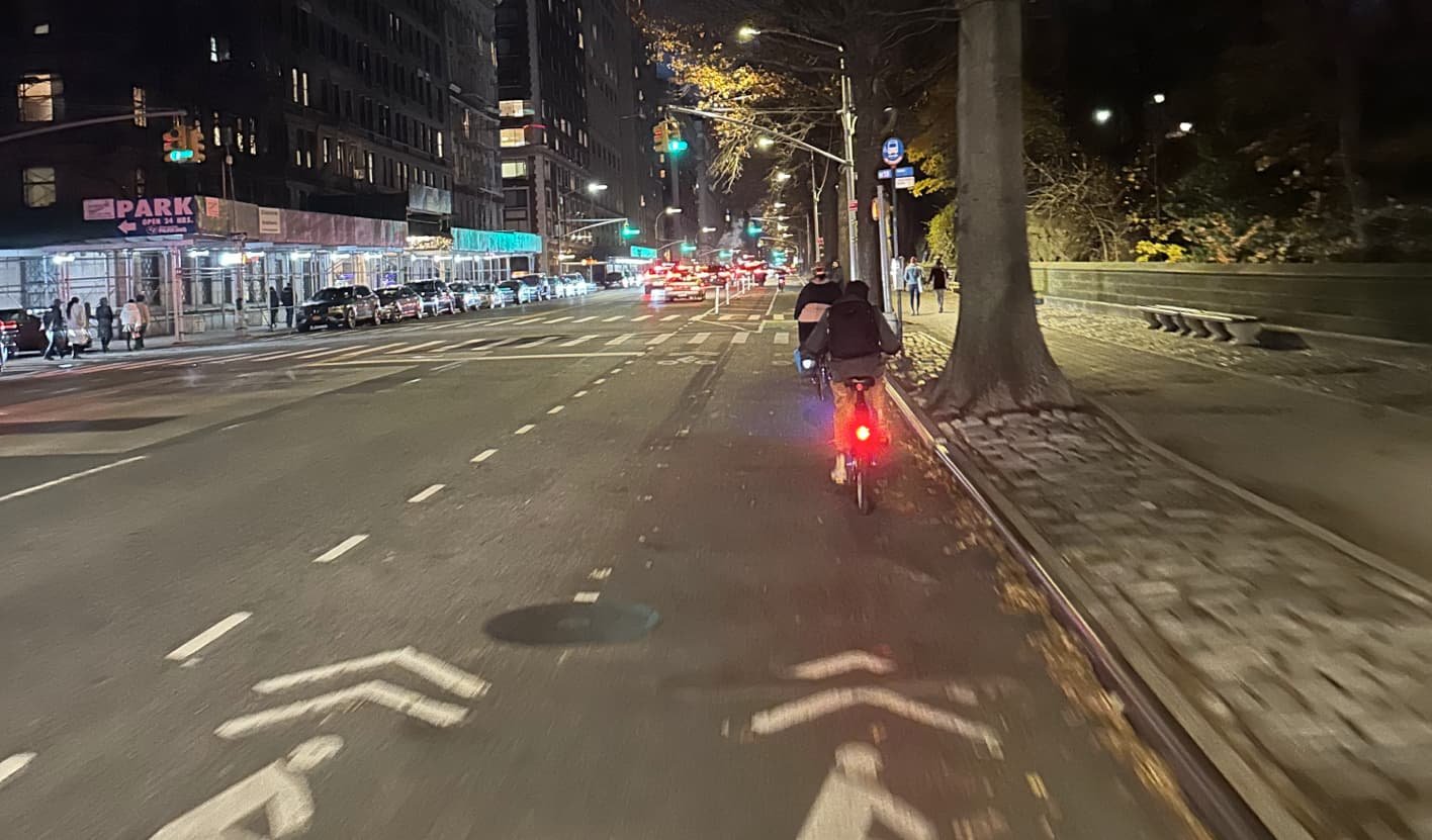
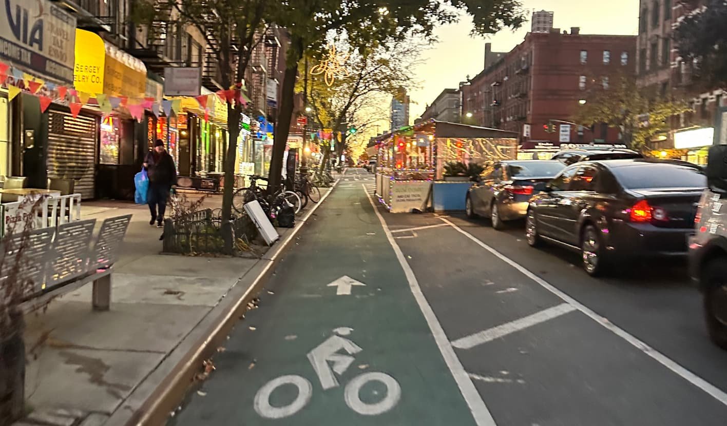
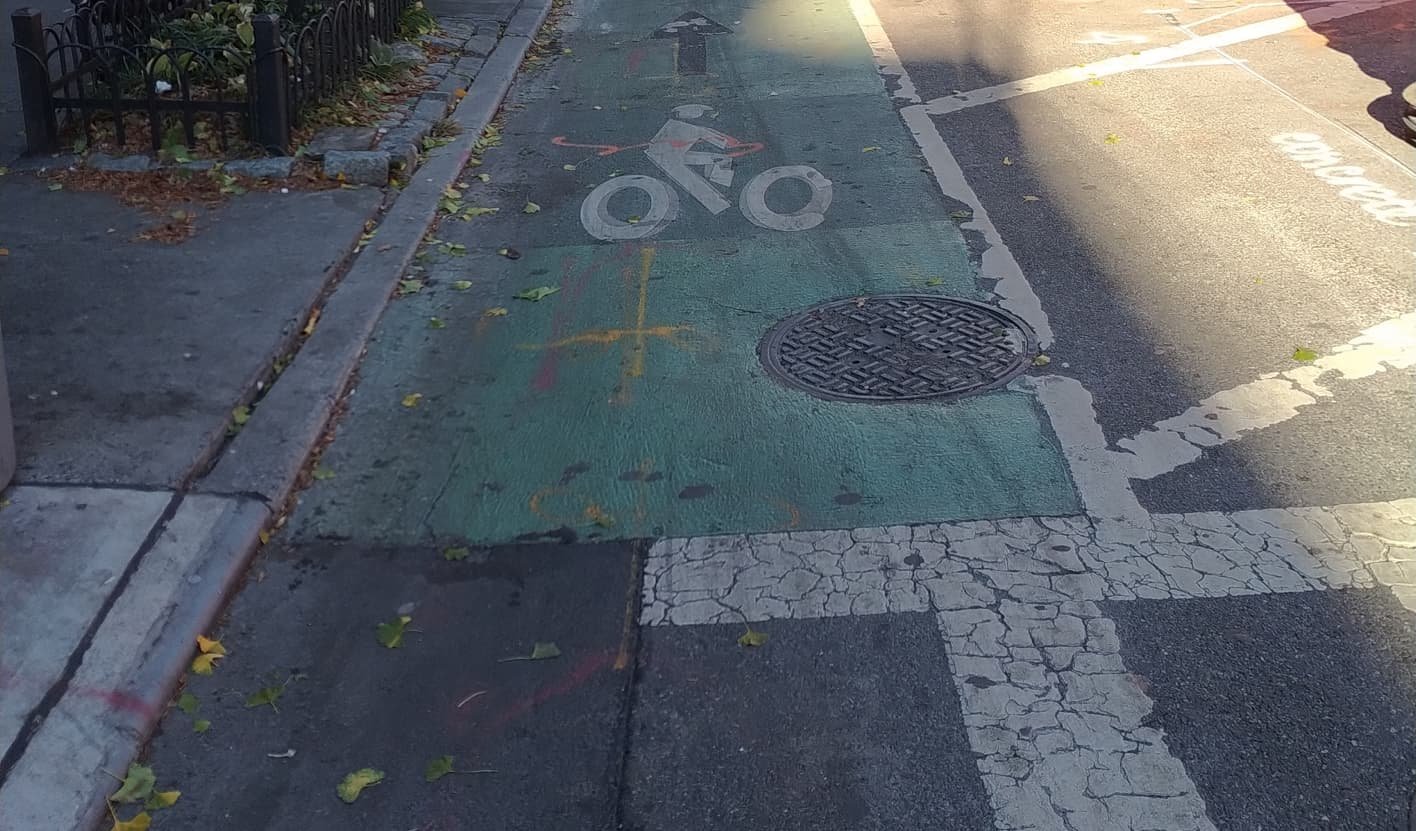
Though designated as “protected”, the only protection for most of the length is paint and plastic. We observed this route to be generally usable for confident micromobility users; however, several conditions make it challenging for more cautious and vulnerable riders and dangerous at certain conditions for all riders.
Six Key Elements

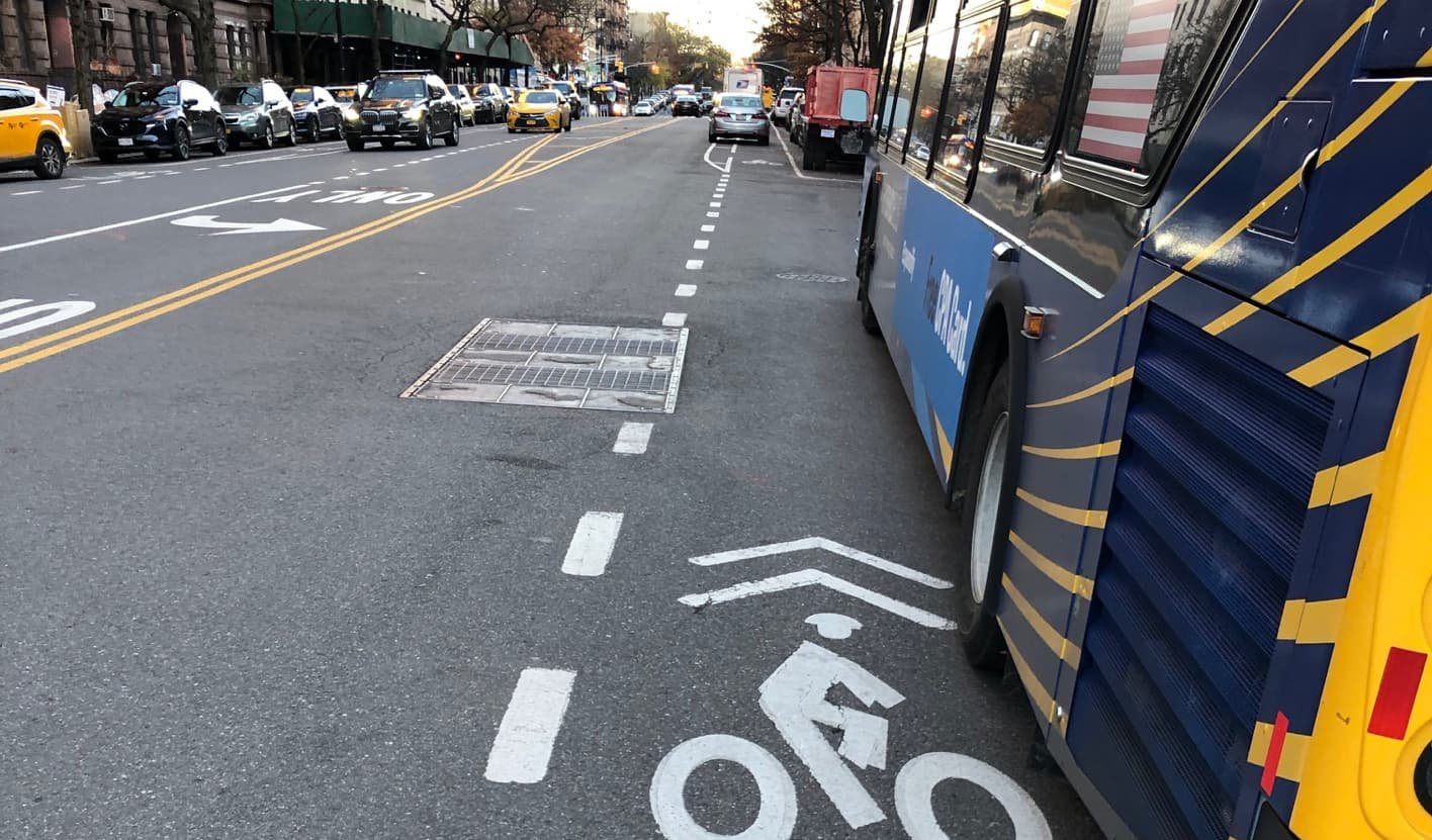
Width
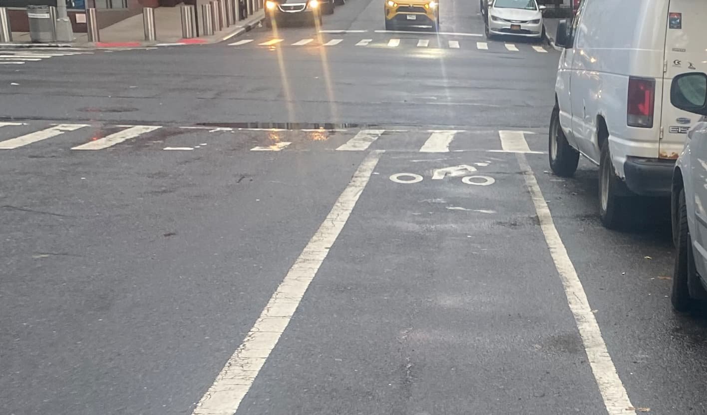
The green painted portion of this lane is nominally six feet wide, and functionally wider in some areas with a striped buffer; however, the buffer width is inconsistent and surface conditions, obstructions, and wrong way riding narrow the lane considerably at points.


Separation
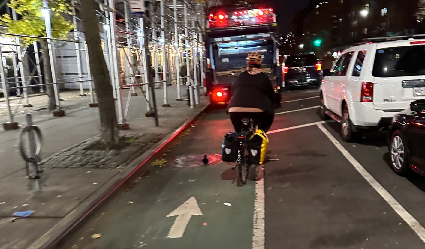
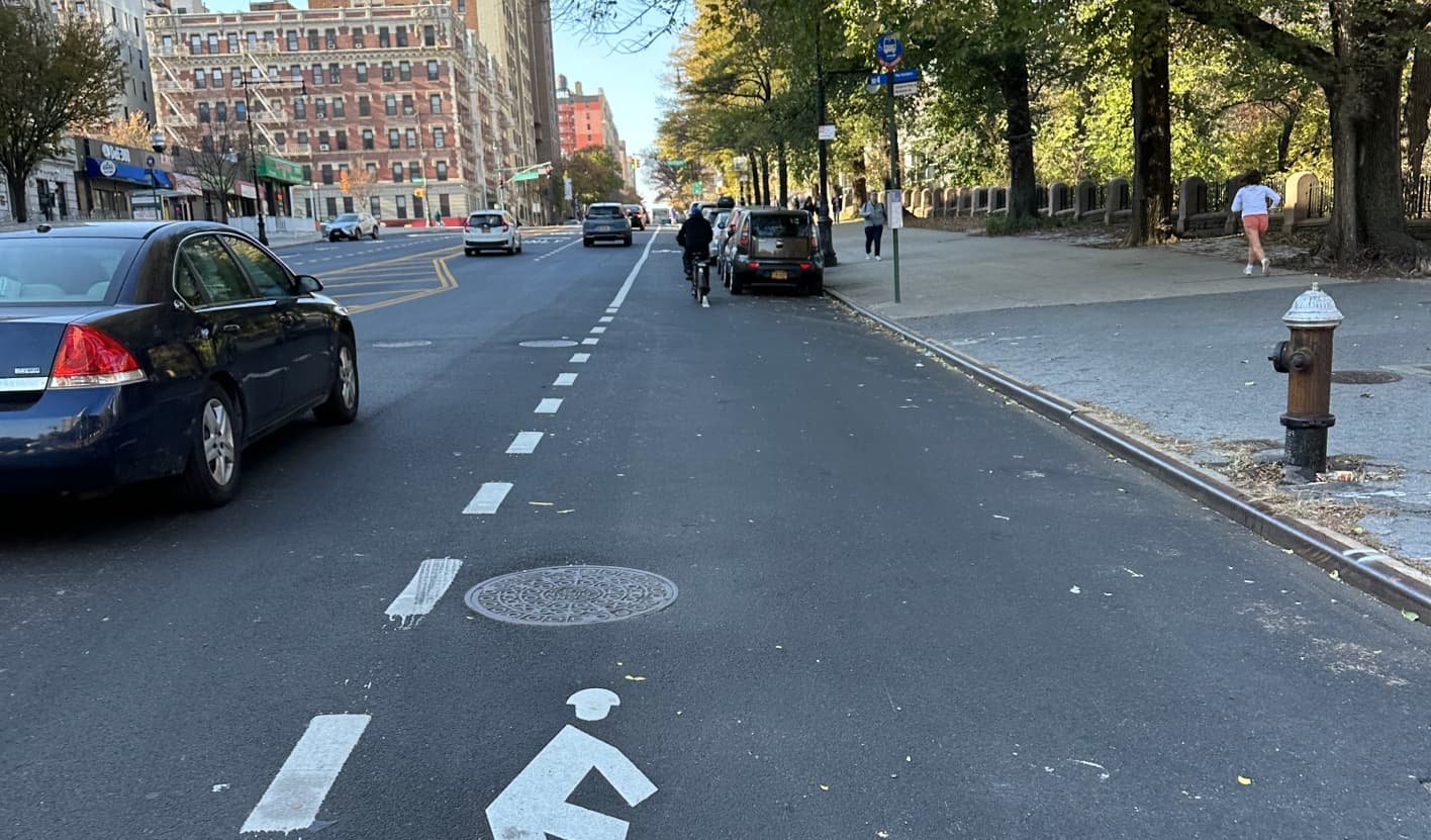
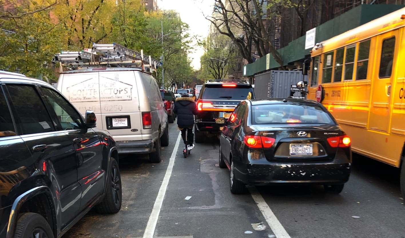
Flex posts and paint are the only real protection on this lane, and these elements are missing entirely at nearly half of the blocks on the route. This is most notable at each of the twenty-two bus stops where the design requires buses to enter and obstruct the bike lane to pick up passengers at the curb.


Intersections
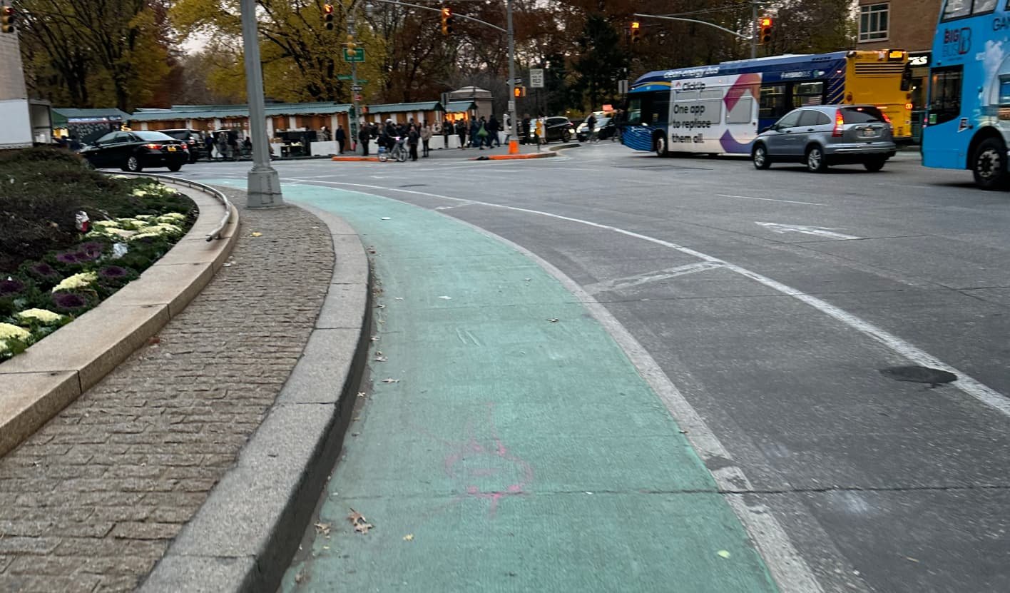
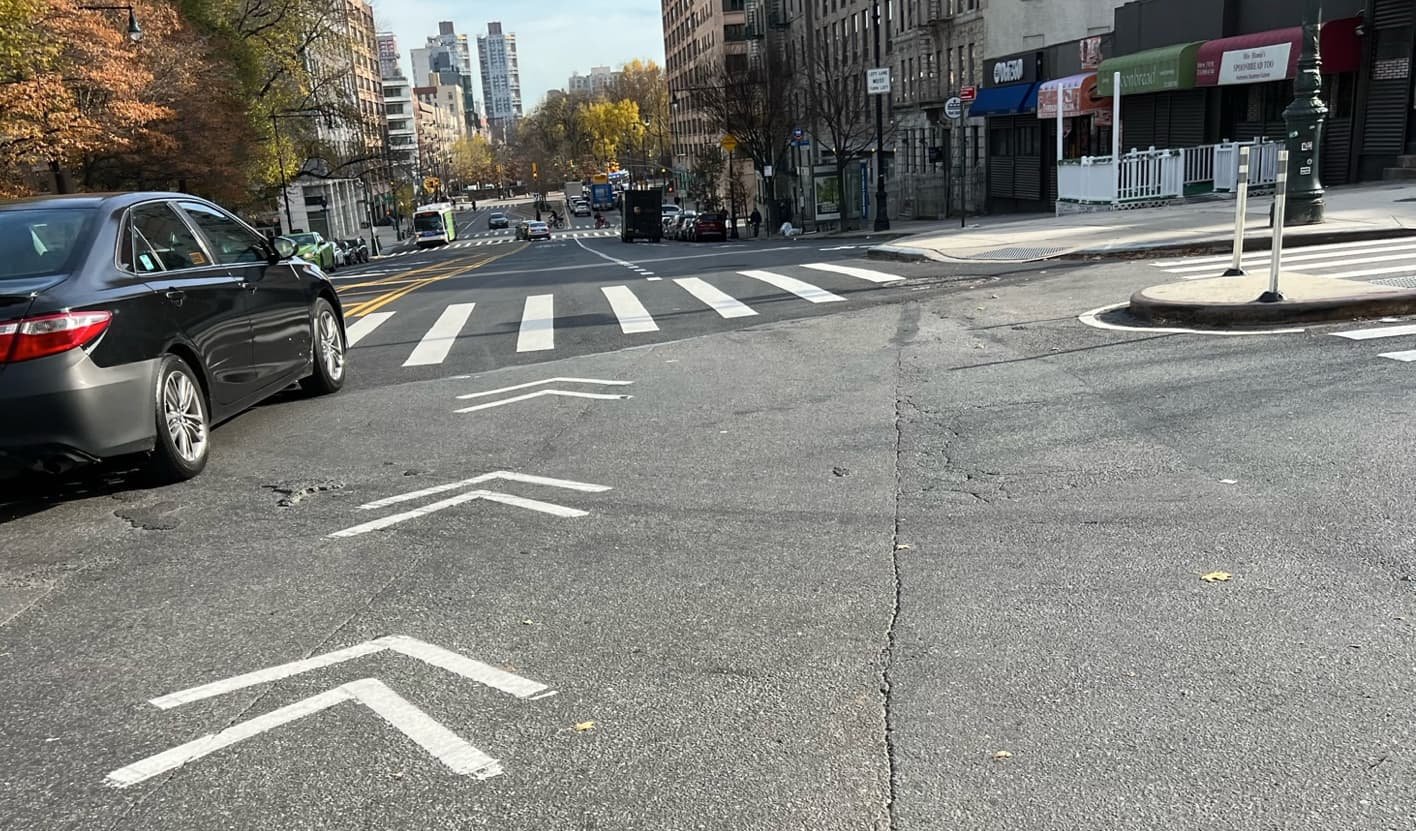
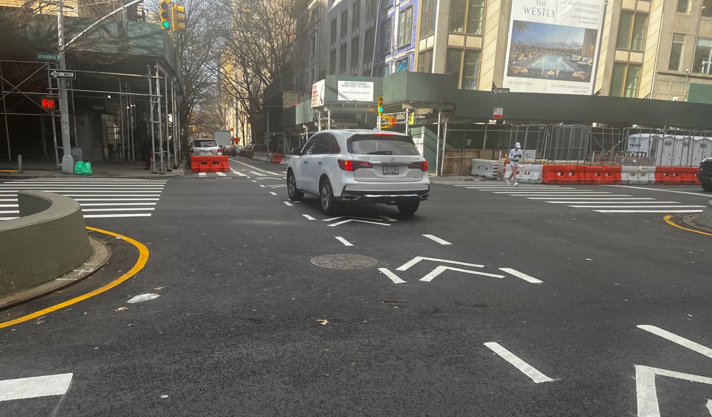
We observed conflicts at every intersection, where vehicles turned both right and left across the bike lane, without properly yielding to bikes, to access each of the four transverses. The roundabouts at Frederick Douglass Circle and Columbus Circle are completely unprotected and dangerous for all riders.


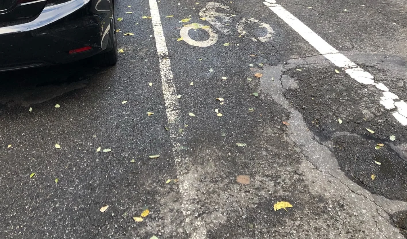
Surface
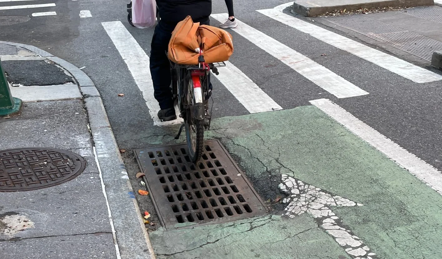
29% of the blocks observed by our volunteers were noted as rough, while 86% were observed to have metal plates and grates, which can create slippery and bumpy conditions. Also, leaves and standing water were observed gathered in several places narrowing the lane, and in some cases forcing riders to leave the facility altogether.


Legibility
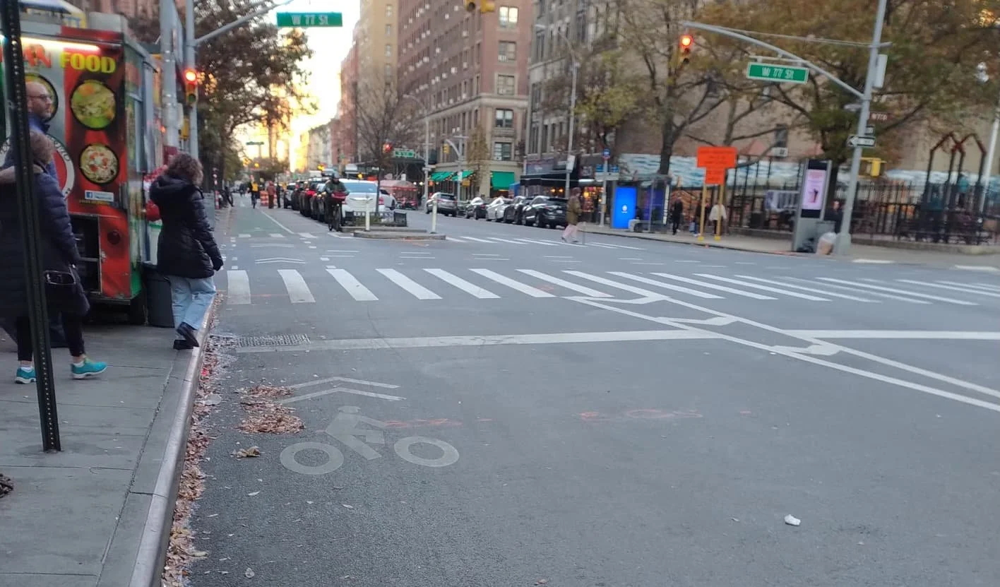
About half of the blocks of this lane are clearly marked and fairly easy for riders of all levels to navigate intuitively. But the gaps at bus stops are significant enough that vulnerable riders might experience some confusion or trepidation, and the connections to other bike infrastructure are often unclear or confusing.


Continuity
The conditions of this lane are not continuous and vary in safety and accessibility at several points. Our volunteers found 14.6% of the lanes they observed to be obstructed by vehicles, often at points where the green paint disappears at intersections and bus stops.


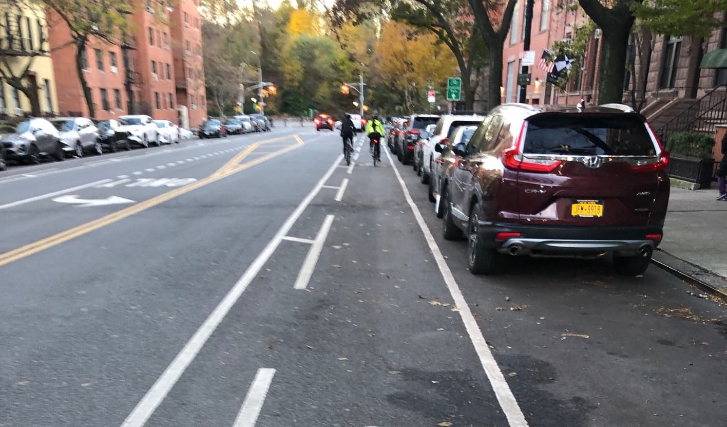
Confident and even cautious micromobility users will likely find most blocks of this lane a relief from the lack of protection on most other streets; however, several aspects make this lane inaccessible and unsafe for vulnerable users. The one-way nature of this lane means riding in the wrong direction is common and puts additional strain on this already undersized infrastructure.
Six Key Elements
Width
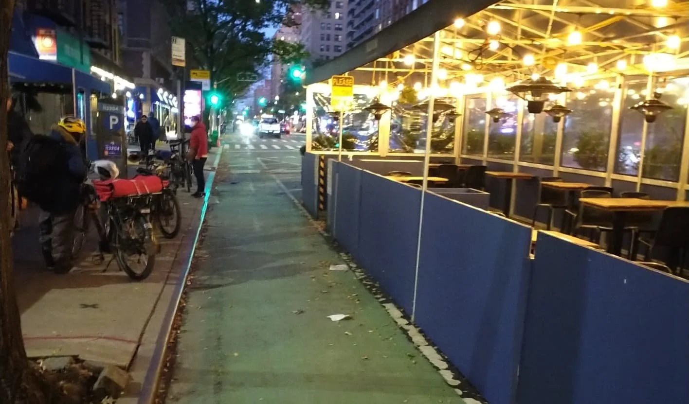
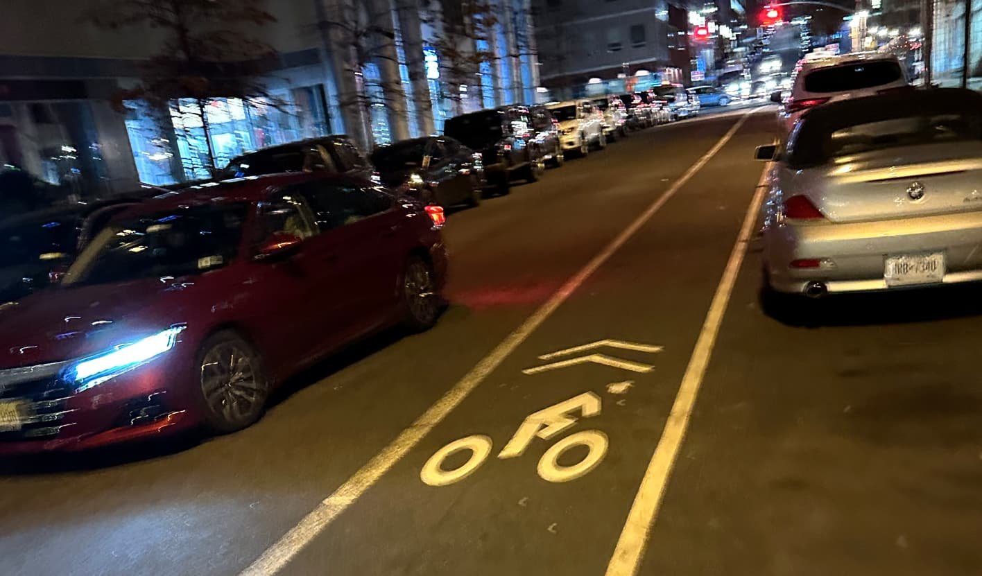
The painted portion of this lane is nominally six feet wide and wider in practice as many riders use the striped buffer, where it’s available, for passing and riding the wrong way. However, rough surface conditions functionally narrow the lane in many places, and several restaurant structures are built right up to the edge, effectively shrinking the comfortable riding width by 20”, making passing in those areas difficult and social riding impossible.


Separation
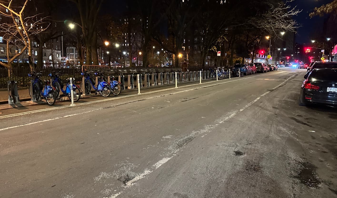
The parking protection provides meaningful separation from cars; however, there are several areas where this protection disappears—turning lanes at intersections, for example—that might not be comfortable to more vulnerable users. The stretch from 67th Street to 64th Street has no protection nor separation from vehicles, leaving even confident riders vulnerable.


Intersections
Vehicles making left turns across the bike lane create conflicts that may be a deterrent to more vulnerable riders. Drivers tend not to look for bikes in these circumstances and not all intersections have treatments to slow turning vehicles. We also found that turning cars tend to stop halfway into the bike lane to wait for pedestrians, effectively obstructing the lane.


Surface
22% of the blocks observed by our volunteers were noted to have dips, cracks, or bumps, while 76% were observed to have metal plates and grates, all of which leads to fairly bumpy conditions that create hazards for all riders and be especially uncomfortable, and perhaps dangerous, for devices with smaller wheels.


Legibility
On continuous blocks the lane is clearly marked and fairly easy for riders of all levels to navigate intuitively. But the gaps at bus stops are significant enough that vulnerable riders might experience some confusion or trepidation.


Continuity
The protected conditions of this lane are fairly continuous with some exceptions, notably the blocks between 67th Street and 64th Street, which are unsafe for all riders. Loose trash and debris were noted on 8% of the blocks observed, while puddles and standing water were observed on 14% of the blocks.


This lane is the northbound companion to the Columbus Avenue bike lane and has many of the same qualities and issues. As with Columbus, confident and even cautious micromobility users will likely find most blocks of this bike lane a relief from the lack of protection on most other streets; however, there are notable conditions that make it less than fully accessible and safe for vulnerable users. And because this lane is one-way headed north, wrong-way riding is common and puts additional strain on what is an already undersized bike lane.
Six Key Elements
Width
Like Columbus, the nominal six foot width and five foot buffer is theoretically wide enough to accommodate many modes and uses. In practice there are segments with a rideable width too narrow to accommodate social riding or passing, much less a de facto two-way lane. Surface conditions narrow the lane in many places as well, and restaurant structures built right up to the edge of the bike lane effectively reduce the rideable width in those areas to 34”, narrower than the recommended comfortable riding width for a single bike, much less cargo or freight bicycles.


Separation
The parking protection provides meaningful separation from cars; however, there are several areas where this protection disappears—turning lanes at intersections, for example—that might not be comfortable to more vulnerable users. The stretch from 69th Street to 74th Street has no protection or separation from vehicles, creating confusing and dangerous conditions and leaving even confident riders vulnerable.


Intersections
We observed cars often make right and left hand turns across the bike lane to access the transverses without properly yielding to bikes, which creates a stressful and dangerous condition for riders of all comfort levels. The intersections alone likely make this route functionally inaccessible to vulnerable riders.


Surface
46% of the blocks observed by our volunteers were noted to have dips, cracks, or bumps, while 53% were observed to have metal plates and grates, all of which leads to bumpy conditions that create hazards for all riders and be especially uncomfortable, and perhaps dangerous, for devices with smaller wheels.


Legibility
Much like Columbus Avenue, the majority of the blocks of this lane are clearly marked and fairly easy for riders of all levels to navigate intuitively, with the notable exception of the blocks between 69th Street and 74th Street, where the design and markings are dangerous and confusing for even the most confident and experienced rider.


Continuity
The protected conditions of this lane are generally continuous with some exceptions, notably the blocks between 69th Street and 74th Street, which are unprotected and unsafe for all riders. Our volunteers found 9.4% of the lanes they observed to be obstructed by vehicles. Construction was noted to be obstructing 17% of the lanes observed. Loose trash and debris were noted on 26% of the blocks observed, while puddles and standing water were observed on 12% of the blocks.


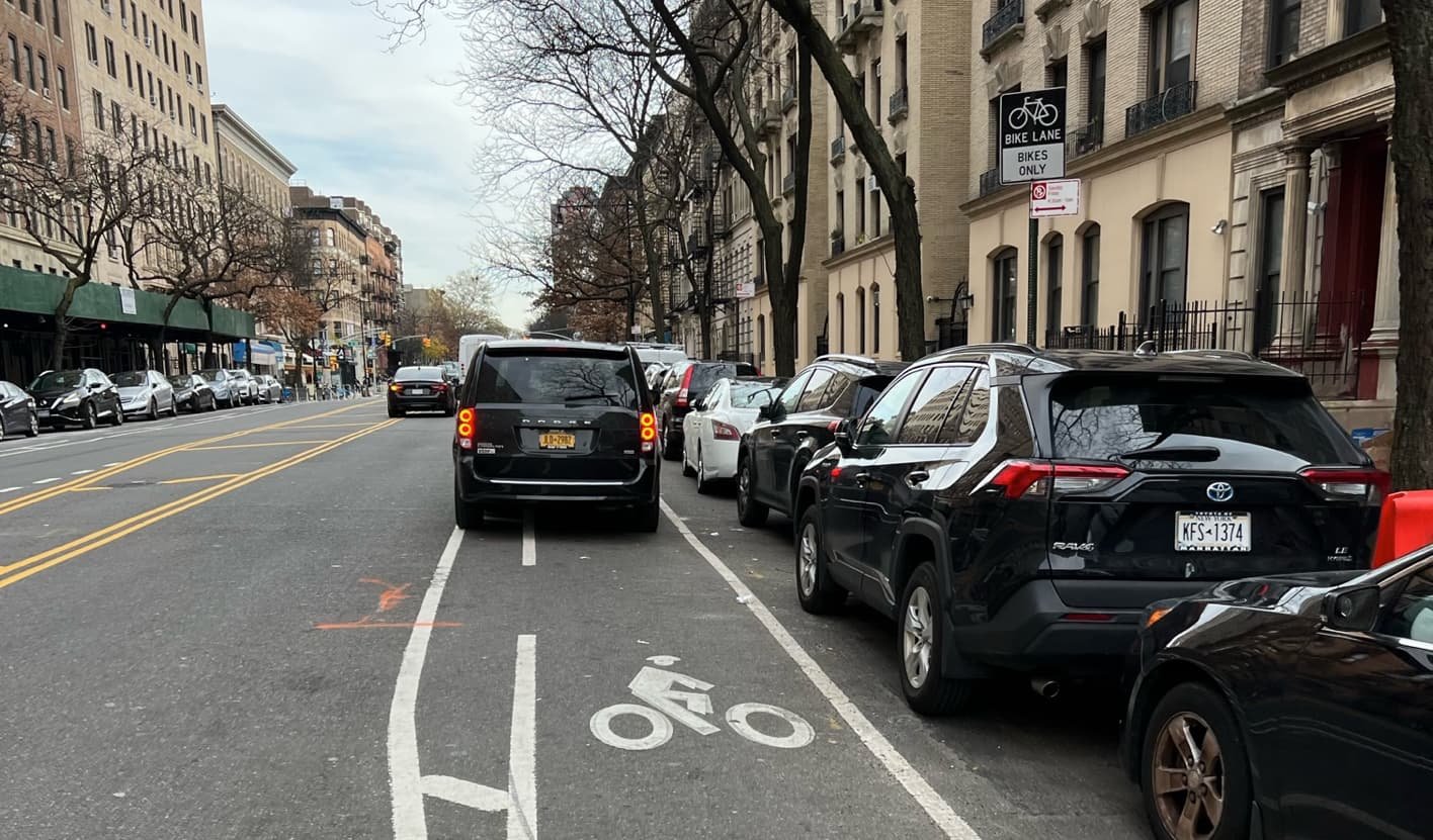
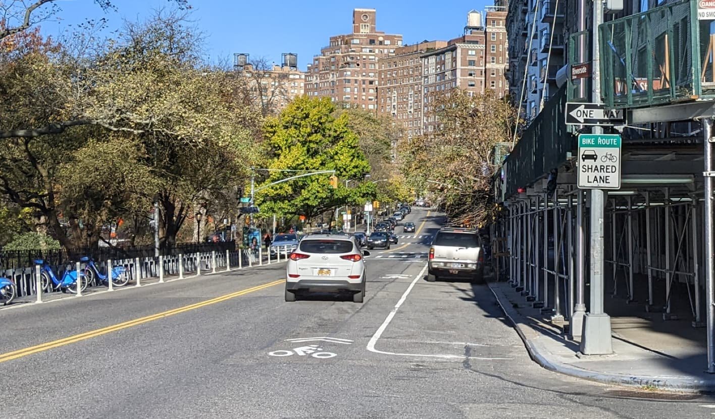
Despite appearing on the official bicycle map, we couldn’t find any signage or markings to indicate this is a designated bicycle route. One volunteer commented of this route, “Very hazardous for anyone riding a bike, even those experienced.”
Six Key Elements
Width
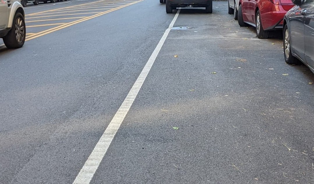
There is no bike lane along this route, though our volunteers observed riders using the narrow space between moving vehicles and parked cars. Riding close to parked cars like this presents the risk of being “doored”—when a driver or passenger unexpectedly opens the car door into the path of a micromobility user, causing a crash.


Separation
There is no physical separation from moving vehicles, and no paint or markings entitling micromobility users to any strip of pavement, creating dangerous conditions where riders must frequently mix with vehicle traffic.


Intersections
Intersections are wide and unprotected with seemingly little regard for the comfort and safety of micromobility users (or pedestrians).


Surface
Portions of this street appeared recently repaved, though our volunteers still recorded 16% of the blocks they observed to have dips, cracks, or bumps. Another 12% of the blocks observed were noted to have metal plates and grates, all of which leads to bumpy conditions that create hazards for all riders and are especially uncomfortable, and perhaps dangerous, for devices with smaller wheels.


Legibility
There were no markings or signage to suggest this is a micromobility route of any kind.


Continuity
In addition to the lack of infrastructure, riders using the door zone space as an ad hoc micromobility lane have to contend with ample double parking. Our volunteers observed 48% of blocks to be obstructed by vehicles, including 18% obstructed by delivery vehicles. Additionally, 8% of blocks were observed to be blocked by construction.


Lack of separation or protection, combined with being located in a driver’s side door zone, as well as frequent obstructions that force riders into traffic, make this route uncomfortable and functionally inaccessible to most users, especially the most vulnerable riders.
Six Key Elements
Width
This lane is minimally wide to accommodate a single bicycle, but likely not wide enough for cargo/freight bikes or tricycles when shy distance from parked cars and moving vehicles is considered. It would be impossible for parent to socially ride with a child in this lane, forcing the child too close to parked cars and the parent into the motor vehicle lane.


Separation
There is no meaningful separation from motor vehicles with this type of “conventional” lane, making it inaccessible to most users, particularly vulnerable riders.


Intersections
Intersections along this route require micromobility riders to mix with motor vehicles to a degree that might feel uncomfortable for most riders, and we observed many drivers using the designated bike lane as a right-turn lane. The intersection at Frederick Douglass Circle is chaotic and dangerous for all riders, regardless of level of confidence or experience.


Surface
Only 12% of blocks observed by our volunteers were described as rough, though 27% were observed to have dips, cracks, or bumps, and 54% were and 54% were found to have metal plates and grates, which can create slippery and bumpy conditions. Some people might intuitively ride around noticeable rough patches or metal grates, taking them out of the bike lane and into the vehicle travel lane.


Legibility
The designated lane was fairly clear for most of the route; however, there are stretches—mostly at intersections and bus stops—where the designated lane becomes a shared lane, which might be confusing for less experienced and more vulnerable riders.


Continuity
Our volunteers found two-thirds of the blocks they observed to be obstructed by vehicles, negating any intended benefit this unprotected lane might have. The design also allows buses to cross the lane at several points per block, which again puts vulnerable riders in an uncomfortable and dangerous situation. All of which makes this lane functionally inaccessible to most riders.


Though our volunteers generally observed low traffic volumes, lack of separation or protection, combined with being located in a driver’s side door zone, as well as frequent obstructions that force riders into traffic, make this route uncomfortable and functionally inaccessible to most users, especially the most vulnerable riders.
Six Key Elements
Width
Like 110th, the lane is minimally wide to accommodate a single bicycle, but likely not wide enough for cargo/freight bikes or tricycles when shy distance from parked cars and moving vehicles is considered. It would be impossible for a parent to socially ride with a child in this lane, forcing the child too close to parked cars and the parent into the motor vehicle lane.


Separation
There is no meaningful separation from motor vehicles with this type of “conventional” lane, making it inaccessible to most users, particularly vulnerable riders. One volunteer observed, “It is not a particularly safe route because, despite the fact that traffic volumes are low, drivers are unpredictable and u-turns are common.”


Intersections
Similar conditions exist as at 110th. Intersections along this route require micromobility riders to mix with motor vehicles to a degree that might feel uncomfortable for most riders. One volunteer observed “Vehicles tend to bunch up on this approach to Broadway and can be impatient, which makes it important to be assertive,” making it inaccessible to many users, particularly vulnerable riders.


Surface
26% of blocks were observed to have dips, cracks, or bumps, and 15% were found to have metal plates and grates. Some people might intuitively ride around noticeable rough patches or metal grates, taking them out of the bike lane and into the vehicle travel lane.


Legibility
On continuous blocks the lane is clearly marked and fairly easy for riders of all levels to navigate intuitively. But the gaps at bus stops are significant enough that vulnerable riders might experience some confusion or trepidation.


Continuity
Our volunteers found 49% of the blocks they observed to be obstructed by vehicles, negating any intended benefit this unprotected lane might have. The design also allows buses to cross the lane at several points per block, which again puts vulnerable riders in an uncomfortable and dangerous situation. All of which makes this lane functionally inaccessible to most riders.


These blocks are intended to act in tandem to create an unprotected crosstown connection between Riverside Park and Central Park. Relatively low traffic volume makes these blocks somewhat accessible to confident cyclists, but children and those more vulnerable would likely find it intimidating. The narrow lane and frequent obstructions mean that much of the riding is done in the center of the traffic lane, leaving riders vulnerable to impatient, inattentive, or aggressive drivers.
Six Key Elements
Width
The designated lane, located in a passenger side door zone, is minimally wide to accommodate a single bicycle, but likely not wide enough for cargo/freight bikes or tricycles when shy distance from parked cars and moving vehicles is considered. It would be impossible for a parent to socially ride side-by-side with a child in this lane, instead forcing the parent into the center of the street where they are vulnerable to motor vehicle traffic approaching from behind.


Separation
There is no separation from motor vehicles with this type of “conventional” lane, making it inaccessible to most users, particularly vulnerable riders. One volunteer observed, “Very dangerous when a honking car approaches from behind at the same time delivery vehicle obstructs the bike lane.”


Intersections
Intersections along this route require micromobility riders to mix with motor vehicles to a degree that might feel uncomfortable for most riders.


Surface
About a third of blocks observed by our volunteers were described as having rough conditions, while 20% were observed to have metal plates and grates, which can create slippery and bumpy conditions. Some people might intuitively avoid riding over rough patches or grates forcing them into the center of the travel lane or uncomfortably close to parked cars.


Legibility
The designated lane was fairly clear for most of the route.


Continuity
Our volunteers found over half of the blocks they observed (54%) to be obstructed by vehicles, negating any intended benefit this unprotected lane might have. One volunteer observed on a particular block, “Buses and construction on both sides of the street meant moving vehicles were on the bike lane for most of the block.”


Much like the blocks on 91st and 90th Streets, these blocks are intended to act in tandem to create an unprotected crosstown connection between Riverside Park and Central Park. Relatively low traffic volume makes these blocks somewhat accessible to confident cyclists, but children and those more vulnerable would likely find it intimidating. The narrow lane and frequent obstructions mean that much of the riding is done in the center of the traffic lane, leaving riders vulnerable to impatient, inattentive, or aggressive drivers.
Six Key Elements
Width
The designated lane, located in a passenger side door zone, is minimally wide to accommodate a single bicycle, but likely not wide enough for cargo/freight bikes or tricycles when shy distance from parked cars and moving vehicles is considered. It would be impossible for a parent to socially ride side-by-side with a child in this lane, instead forcing the parent into the center of the street where they are vulnerable to motor vehicle traffic approaching from behind.


Separation
There is no separation from motor vehicles with this type of “conventional” lane, making it inaccessible to most users, particularly vulnerable riders. Many volunteers spoke of feeling more comfortable riding in the center of the travel lane, even though it makes riders vulnerable to vehicles approaching from behind.


Intersections
Intersections along this route require micromobility riders to mix with motor vehicles to a degree that might feel uncomfortable for most riders.


Surface
Nearly half of blocks observed by our volunteers were described as having rough conditions, while 10% were observed to have metal plates and grates, which can create slippery and bumpy conditions. Some people might intuitively avoid riding over rough patches or grates forcing them into the center of the travel lane or uncomfortably close to parked cars.


Legibility
The designated lane was fairly clear for most of the route.


Continuity
Our volunteers found 60% of the blocks they observed to be obstructed by vehicles (52% by personal cars), and 30% obstructed by construction, negating any intended benefit this unprotected lane might have.


The shared nature of this lane might be accessible to confident cyclists, but children and those more vulnerable would likely find it prohibitively uncomfortable. Shared lanes are notoriously unsafe and have been shown in studies to be less effective than nothing at all [footnote].
Six Key Elements
Width
The narrow shared zone forces vulnerable riders to ride too close to the door zone of parked cars. Many would choose to ride on the sidewalk instead of sharing this route with motor vehicles.


Separation
The shared street designation offers no separation from moving motor vehicles and would be uncomfortable for most users and dangerous for more vulnerable riders.


Intersections
The intersection at 79th Street has no protection for micromobility users and forces them to queue in front of vehicle traffic at the stop light to access Riverside Park. Vulnerable riders would simply cross with pedestrians in the crosswalk and ride on the sidewalk into the park, making this route useless to them.


Surface
The surface is paved for vehicle traffic and suffers commensurate wear and tear, making it not great for those using micromobility devices.


Legibility
The “sharrows” are visible at entry points to the street, but vulnerable riders may find them confusing since they don’t dedicate actual space for micromobility.


Continuity
Our volunteers did not observe any double parked vehicles obstructing the route, but vulnerable riders would likely not find a such a shared route to be safely continuous.


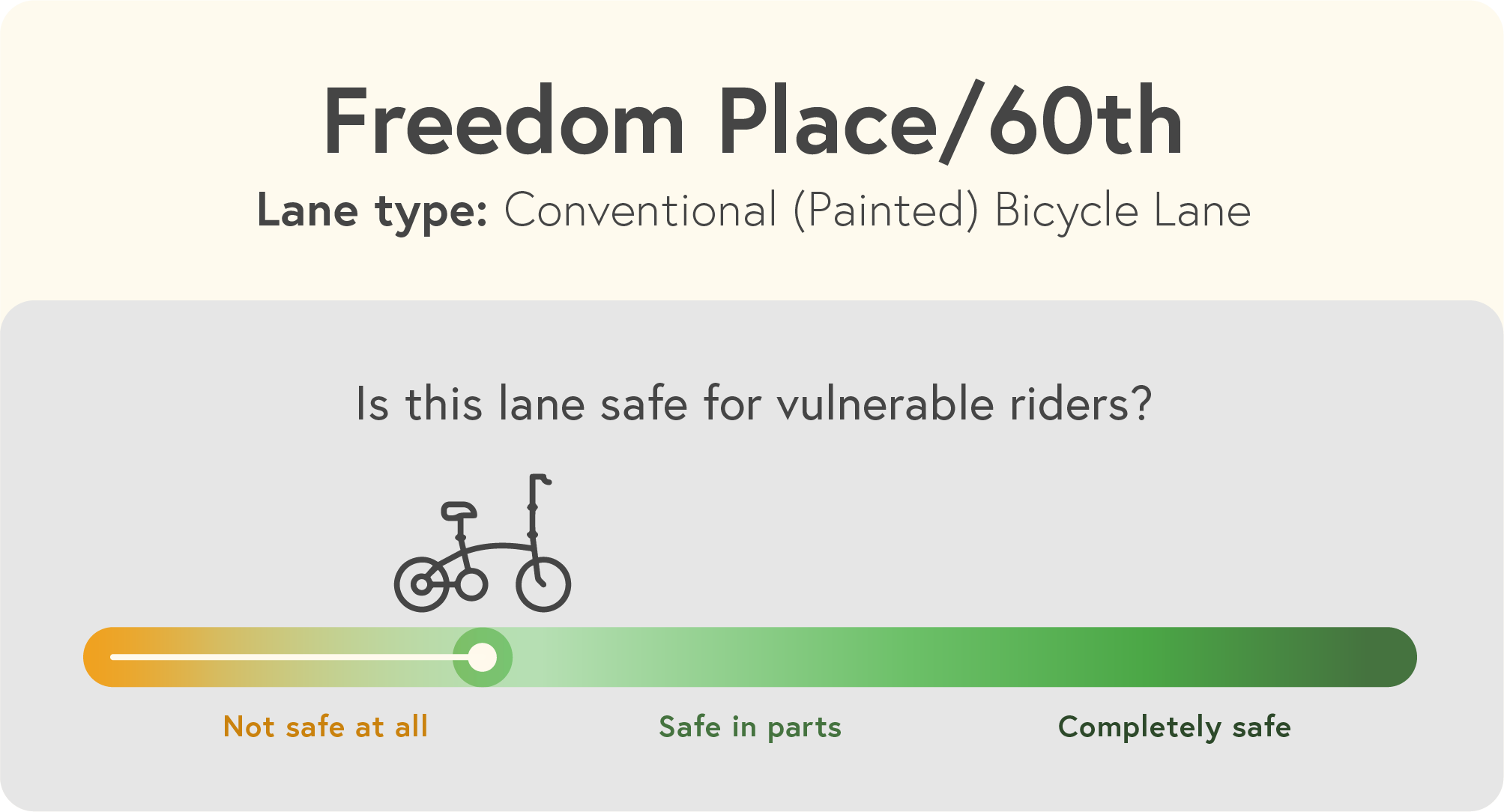
These T-shaped set of lanes sit in isolation on the far west side blocks from any other micromobility infrastructure. We observed low traffic volumes, but frequent obstructions and zero connectivity make these lanes of limited use to anyone and not suitable for vulnerable riders.
Six Key Elements
Width
This lane is minimally wide to accommodate a single bicycle, but likely not wide enough for cargo/freight bikes or tricycles when shy distance from parked cars and moving vehicles is considered. It would be impossible for parent to socially ride with a child in this lane, forcing the child too close to parked cars and the parent into the motor vehicle lane.


Separation
There is no separation from motor vehicles with this type of “conventional” painted lane, making it inaccessible to most users, and particularly unsafe for vulnerable riders.


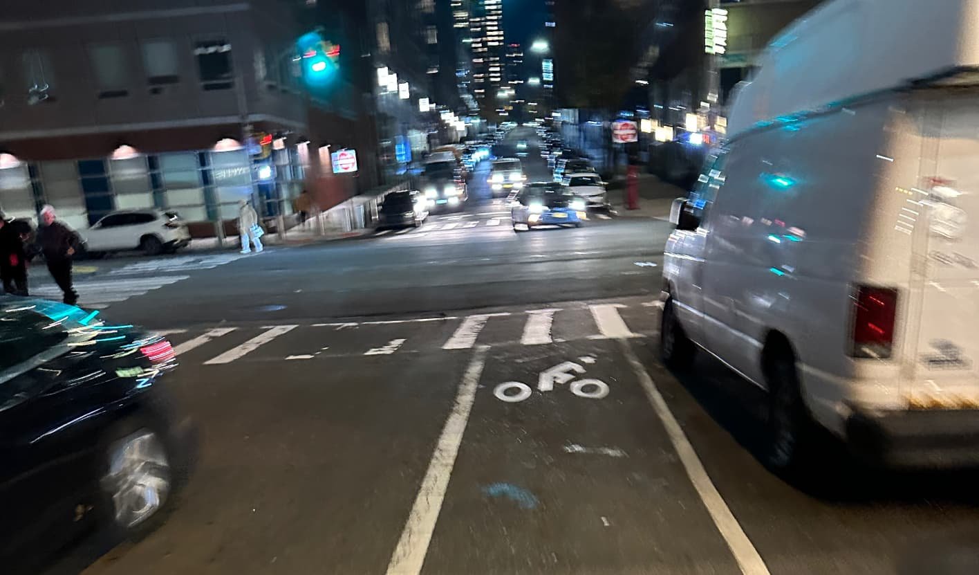
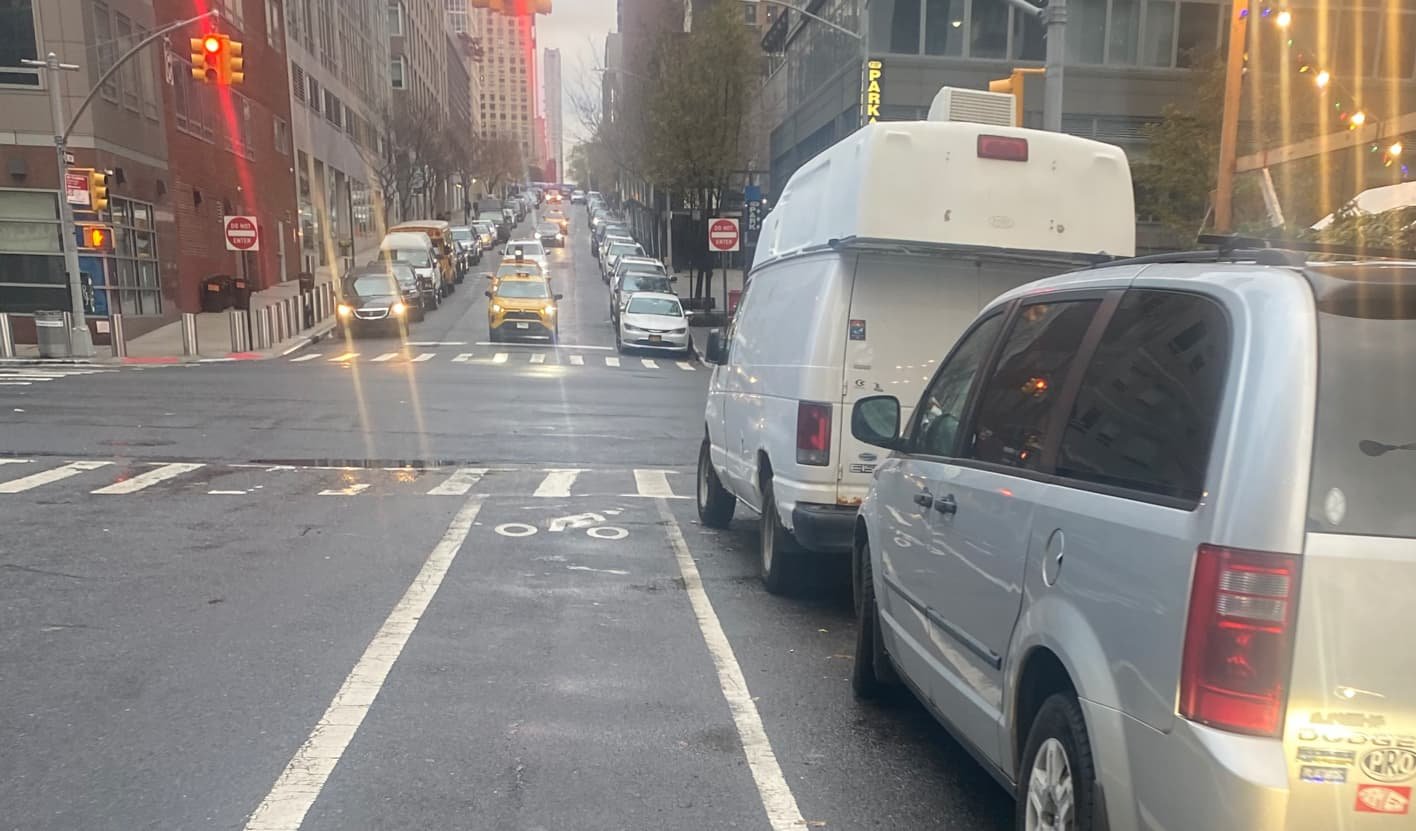
Intersections
Freestanding, moveable stop signs along Freedom Place were observed positioned partially into the bike lane. It’s unclear if these signs are intended primarily for micromobility users, vehicle drivers, or both. Several vehicles were observed encroaching on the bike lane while making right-hand turns.


Surface
One quarter of the blocks were observed to have dips, cracks, or bumps. Many of these conditions occur when the lane runs southbound along the curb, creating a space for standing water to collect, forcing riders into the travel lane.


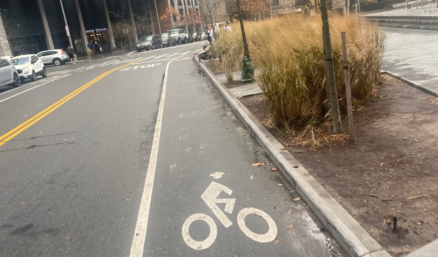
Legibility
The designated lane was clear northbound on Freedom Place, though the southbound lane was obstructed by vehicles, making it difficult to see the markings.


Continuity
Nearly two-thirds of the blocked observed by our volunteers (63%) were found to be obstructed by vehicles, making this route likely unattractive for casual riders and unsafe for vulnerable riders.


